Loading page...
Back to the top of the page
Contact


    3D Laser Scanning

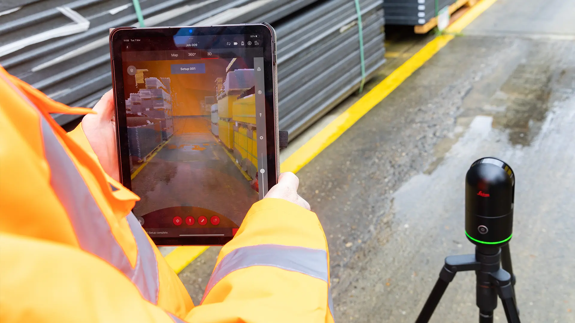
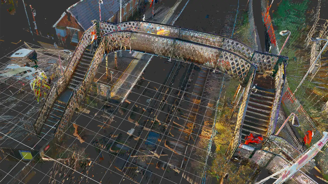
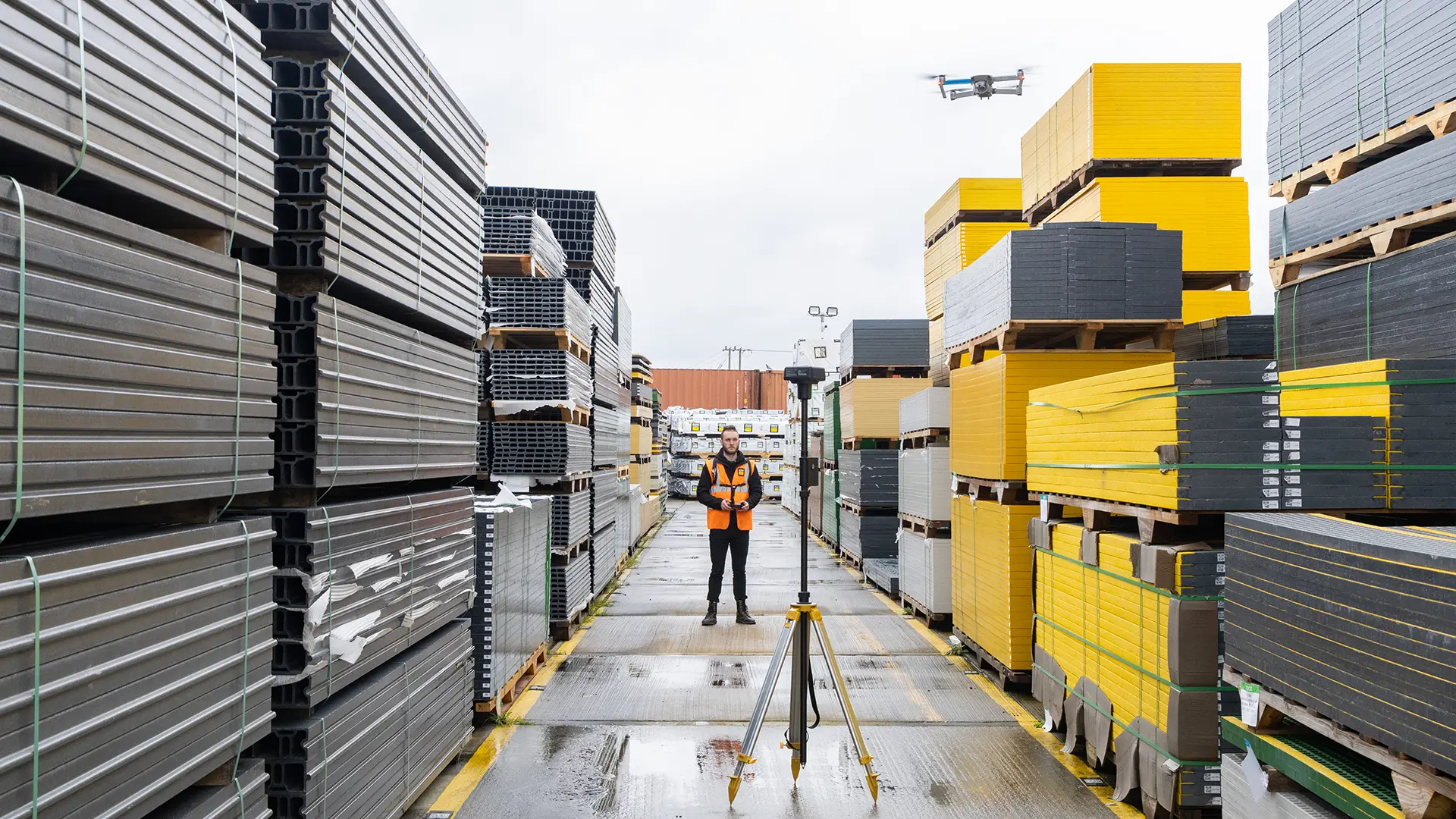
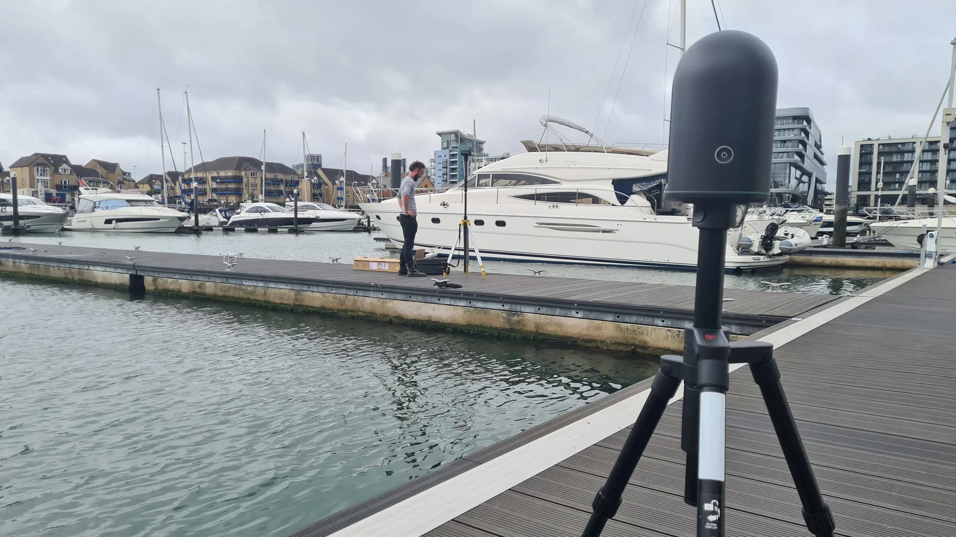
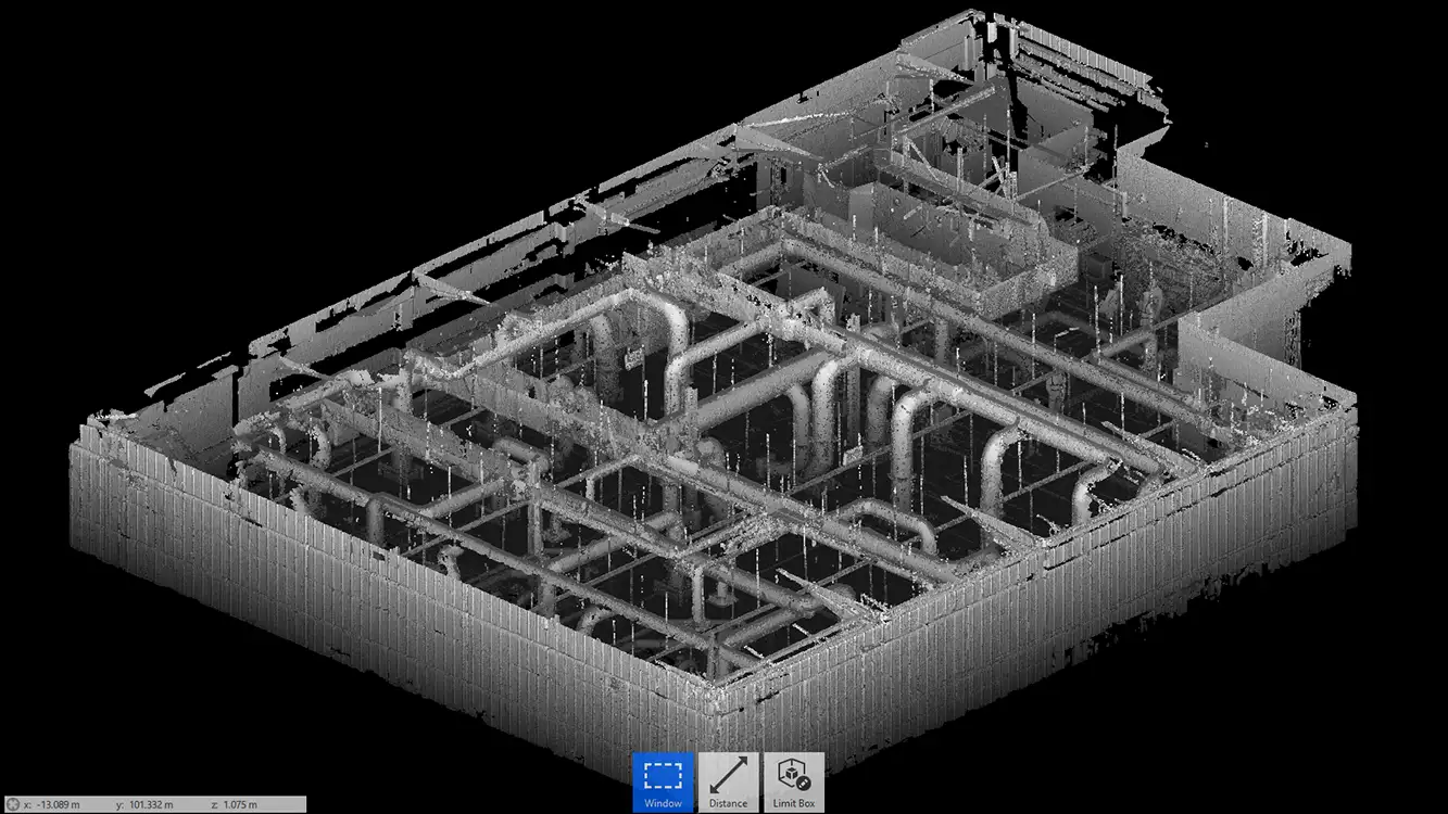
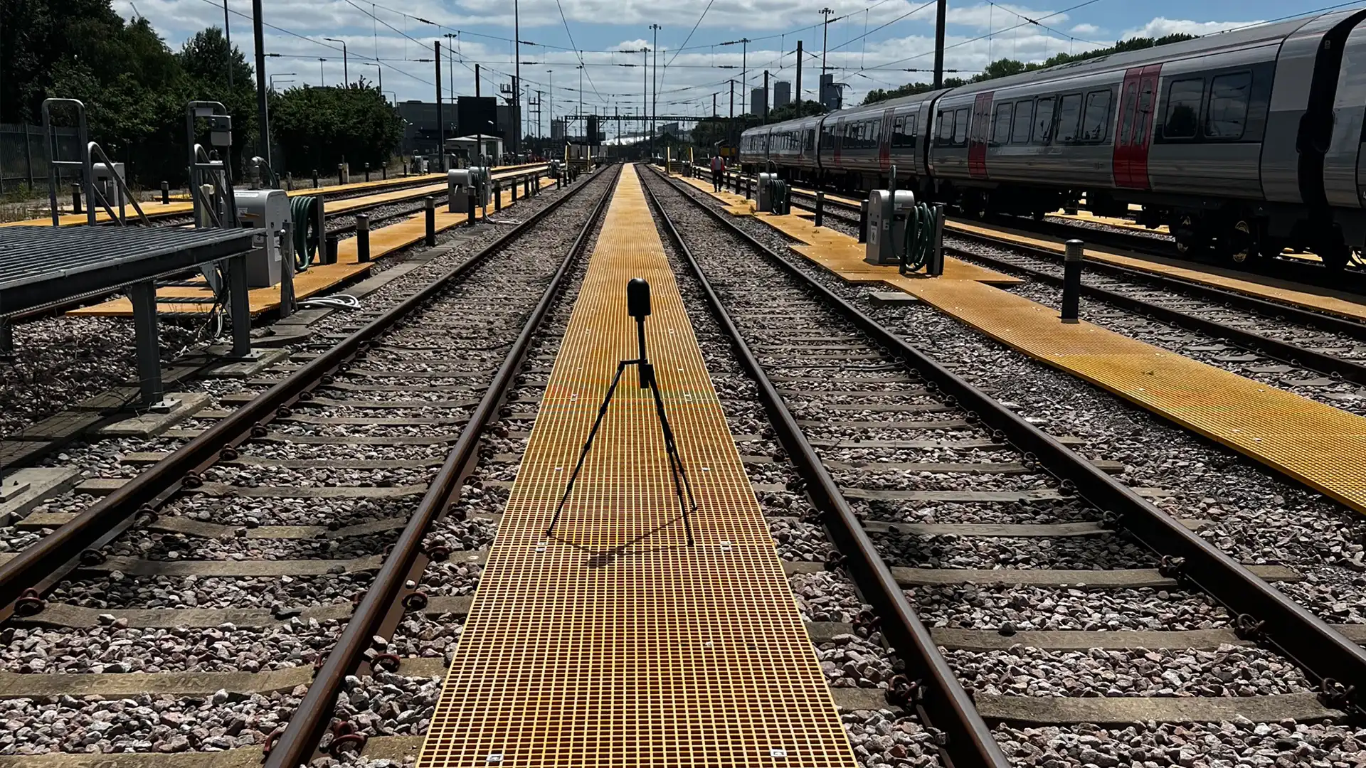
    Laser scanning is a way of visualising and exploring the structure, surface, fixtures or fittings of a building or asset. 3D scanners use light detection and ranging (LIDAR) to measure and record precise locations and distances to produce a point cloud file and help to capture a level of accuracy that would never be possible by hand.

    Particularly useful for areas in continuous use by maintenance personnel or the general public, the scanning can be conducted without disturbing daily activities – and without the need to work at height. It’s also ideal for awkward and difficult to access viaducts as well as many other construction applications, like riser voids, roofing assessments, or planning approvals for new concepts.

    Regardless of industry sector, working with the models created from laser scanning is a great way to minimise waste, in terms of both time and budget. From a project management perspective, it reduces the possibility of problems further down the line, and can be used in conjunction with other technology to allow multiple parties to collaborate on a project.

    Time

    Time Efficiency

    Reduce the time required for surveying and data collection compared to traditional methods. Projects that once took weeks or even months can now be completed in a fraction of the time

    Safety or Warranty

    Safety

    The ability to access difficult, dangerous, or expensive-to-reach areas without exposing manned surveying teams to risk is a major safety advantage

    Measure

    Precision

    Measurements derived from point clouds are accurate to within a few centimetres, ensuring that project plans and designs are built on a solid foundation of data

    The scanning process captures every detail.

    You get an as-built record to use as a basis for producing exact replicas in modern materials. In some cases whole sections or structures may need to be replicated, and in others, the new material can be added to blend seamlessly with the old, such as with degraded timber rail station canopies. We use this as an opportunity to replace the old materials with high-performance fire-rated materials which require minimal maintenance and are significantly lighter in weight.

    Photogrammetric Surveys

    As well as 3D laser scanning, Dura Composites also specialises in photogrammetry 3D mapping using unmanned aerial vehicles (UAVs) or drones. This non-invasive technique allows us to carry out site surveys quickly and safely, with minimal disruption – making linear, point-to-point measurements without the need to manually capture data. Our in-house drone operatives are holders of the A2 Certificate of Competency (A2 CofC) as well as the new General Visual Line of Sight (GVC) certificate required by the Civil Aviation Authority (CAA).

    After taking a multitude of overlapping pictures using the drone, our CAD team uses specialist software to stitch them together into a 3D mesh, which in turn is used to generate a point cloud, a collection of co-ordinates that reveal the contours of various assets within the site. The point cloud can then be used to create site plans, flooring layouts, site models or any other documentation required to assist with the project – with measurements that are accurate to within a few centimetres.

    Pioneered by the Oil & Gas industries for offshore assets, 3D photogrammetry is now used by in a vast range of civil engineering, defence and construction projects thanks to its ability to digitise an area in a fraction of the time that it would take to use traditional, onsite methods. It is particularly valuable for areas that are difficult, dangerous or expensive to access with manned surveying teams.

    Want to know more? Read our insights article

    Our Specialists

    Our innovative recyclable products can help accelerate the construction of critical infrastructure. Talk to our experienced team about how you can tap into our specialist knowledge and engineering capability for your project.