Loading page...
Back to the top of the page
Contact


    Phone

    General Sales | +44 (0) 1255 446838

    Sales Support | +44 (0) 1255 423601 (Option 5)

    Transport | +44 (0) 1255 462567

    Rail | +44 (0) 1255 440291

    Industral & Commercial | +44 (0) 1255 440290

    High-Rise | +44 (0) 1255 446830

    Decking & Cladding | +44 (0) 1255 440298

    Marine | +44 (0) 1255 440297

    Experience the future of surveying and modelling.

    In the realm of modern engineering, the demands for accuracy and efficiency have never been greater. As a leading player in the composites industry, we recognise these demands and offer a cutting-edge solution through our specialised photogrammetric surveys and 3D modelling services. In this article, we delve into the world of technological surveys, showcasing how Dura Composites leverages drones, LIDAR and advanced software to create precise 3D models that revolutionise project planning and execution.

    Photogrammetry: A Non-Invasive Revolution

    Dura Composites has honed the art of 3D mapping through photogrammetry, a non-invasive technique that captures the physical world with unparalleled precision. Unlike traditional methods that involve manual data collection, photogrammetry uses drones to quickly and safely survey sites, minimising disruption while delivering highly accurate results. This approach eliminates the need for intrusive on-site measurements, making it an invaluable tool in various industries.

    • Image Capture: Dura Composites’ drones capture a multitude of overlapping images of the site, ensuring comprehensive coverage.
    • Software Wizardry: Our Design and Engineering teams then step in, using cutting-edge software to seamlessly stitch these images together. This process results in a 3D mesh that serves as the foundation for subsequent steps.
    • Generating the Point Cloud: The 3D mesh is transformed into a point cloud, a precise collection of coordinates that unveil the contours and details of assets within the surveyed area.

    Our professionals hold essential certifications, including the A2 Certificate of Competency (A2 CofC) and the General Visual Line of Sight (GVC) certificate mandated by the Civil Aviation Authority (CAA). These certifications ensure that our aerial operations comply with stringent safety and regulatory standards.

    3D Scanning: The Perfect Solution for Multi-Height Areas

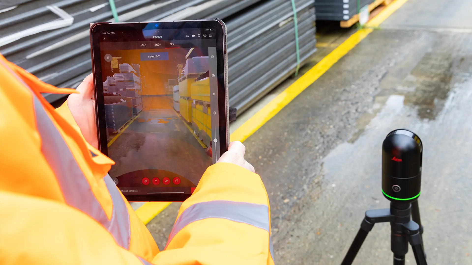
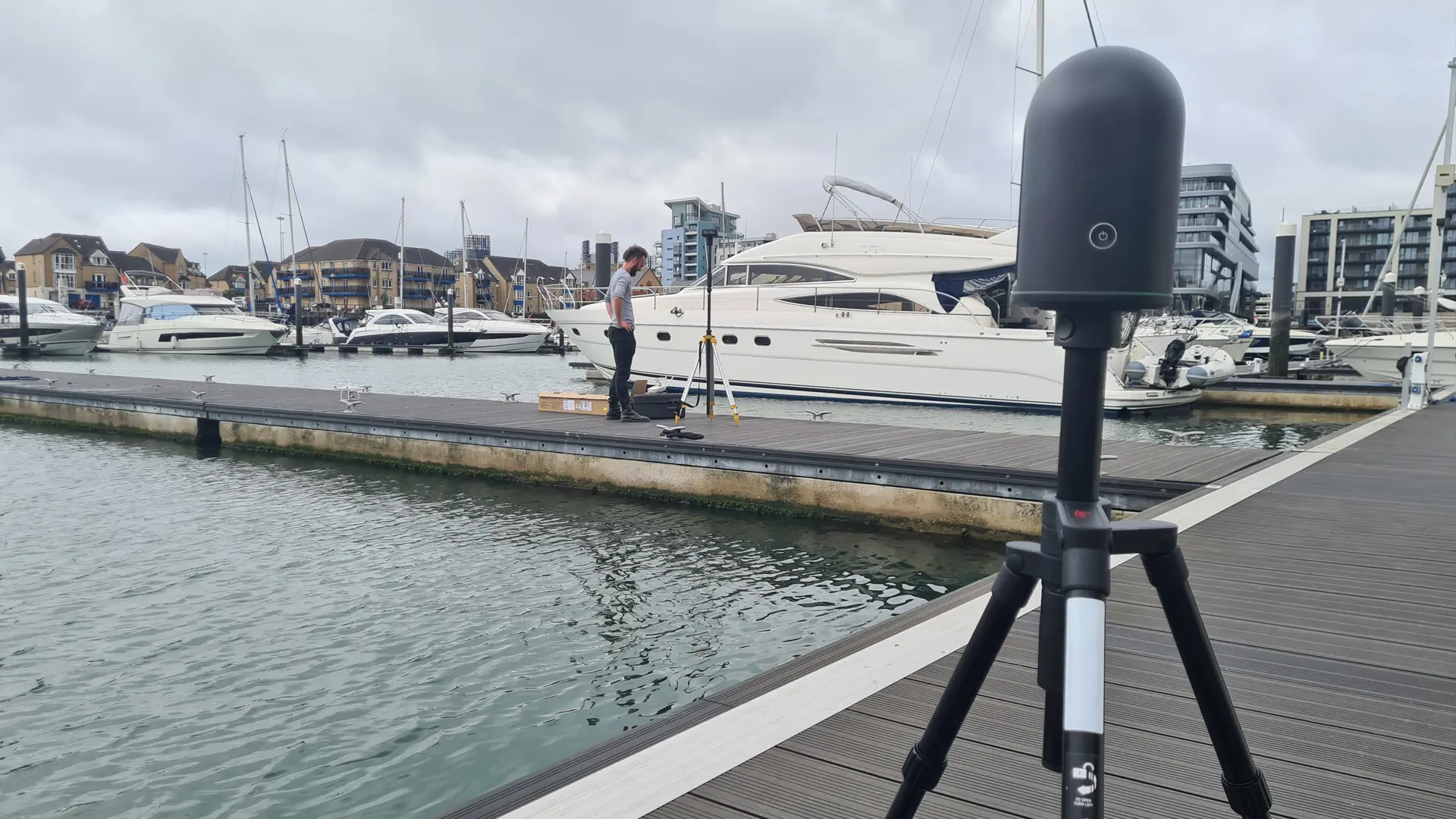
    LIDAR, which stands for Light Detection and Ranging, is a powerful technology widely used in surveying and mapping applications. It operates by emitting laser pulses and measuring the time it takes for them to bounce back after hitting objects, thereby creating highly accurate 3D representations of terrain and structures.

    When applied to trench surveying for example, LIDAR provides rapid and precise information about trench depth, width, and shape, that can be used to define the exact requirements for fabricating removable access covers made from composite products such as Dura Slab and Dura Grating. The technology greatly enhances the safety and efficiency of infrastructure projects by minimising the need for physical inspections and reducing human error.

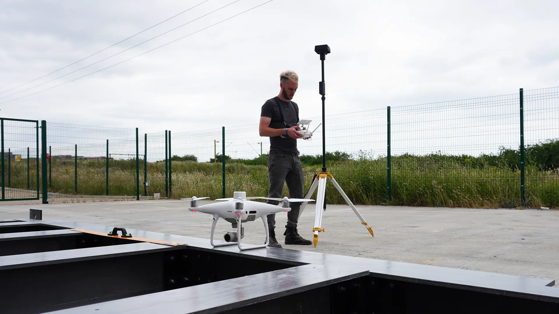
    The applications of Dura Composites’ surveying and 3D modelling are extensive, spanning across industries such as civil engineering, defence, and construction. Key benefits include:

    • Time Efficiency: Photogrammetry drastically reduces the time required for surveying and data collection compared to traditional methods. Projects that once took weeks or even months can now be completed in a fraction of the time.
    • Safety: The ability to access difficult, dangerous, or expensive-to-reach areas without exposing manned surveying teams to risk is a major safety advantage.
    • Precision: Measurements derived from point clouds are accurate to within a few centimetres, ensuring that project plans and designs are built on a solid foundation of data.
    • Cost-Effective: The efficiency and accuracy of photogrammetry translate into cost savings for clients, as it minimises the need for costly on-site resources and rework.